Technical Info
| Map Maker | Ricardo García Dengra |
| Scales | 1:15000/1:10000/1:7500 |
| Contour Interval | 5m |
| Course Planner | José Luis García Morales |
| Distance to Start | 1.700 m. |
Map Maker comments
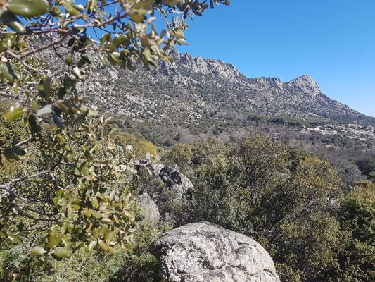
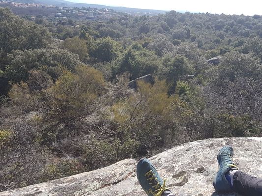
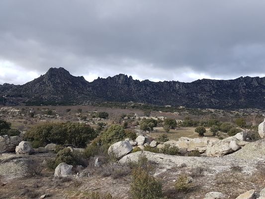
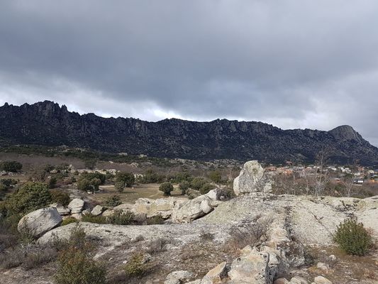
The terrain chosen for the realization of the long distance is to the west of the town of La Cabrera and under the skirt of the mountain range with the same name. The unevenness is moderate between 1000 and 1200 meters, without reaching the steeply sloping areas that characterize the sierra. The vegetation has two strongly differentiated zones, finding the central strip marked by the presence of open zones mixed with “rebollo”, a variety of oak very similar to this one, combined with brambles that do not make the race very difficult due to its dispersed appearance. In the most southern and northern areas of the map, we find mainly holm oaks and rock roses with great density that sometimes make the race very difficult. The rock formations are almost entirely of granite type with a high amount of stones, cut and rocky outcrops of great extension, presenting a high weathering in the northern area of the map. Although from the same cartographer, the map for long distance has a criterion of greater simplification of elements than that of the middle distance.
Course Planner comments
There will be alternation of section types in all categories and in many areas the concentration of controls will be very high, so it is convenient to remember the control number check. The change of environment in the sections has been sought to take advantage of the variety of the map. There are zones of honeycombs of low or no activity duly marked on the ground and represented on the map with the symbol 709 of the prohibited zone without framing. Areas with the same symbol framed are for other reasons. It is not expected that it will be necessary to go through the fences that contain them. The electrical lines that coincide with streets, building boundaries or private properties have been suppressed only in the urban area and do not affect the race.
Lenghts and Slopes
| Distancia Larga/Long Distance | |||||
| Categoría
Class |
Distancia
Lenght |
Desnivel
Slope |
Controles
Controls |
Escala
Scale |
Cambio de mapa
Map change |
| U- 10 | 2,6 | 85 | 12 | 1:7.500 | No |
| F-12 | 3 | 80 | 17 | 1:10.000 | No |
| F-14 | 3,7 | 155 | 19 | 1:10.000 | No |
| F-16 | 5,6 | 140 | 19 | 1:10.000 | No |
| F-18 | 7,2 | 190 | 23 | 1:15.000 | No |
| F-20 | 9 | 260 | 22 | 1:15.000 | No |
| F-21A | 6,6 | 210 | 19 | 1:15.000 | No |
| F-21B | 7,2 | 190 | 23 | 1:15.000 | No |
| F-E | 10,9 | 330 | 28 | 1:15.000 | No |
| F-35A | 7,2 | 265 | 22 | 1:15.000 | No |
| F-35B | 4,1 | 140 | 18 | 1:15.000 | No |
| F-40 | 5,9 | 220 | 22 | 1:15.000 | No |
| F-45 | 4,7 | 170 | 20 | 1:10.000 | No |
| F-50 | 3,7 | 85 | 12 | 1:10.000 | No |
| F-55 | 3,7 | 85 | 12 | 1:10.000 | No |
| F-60 | 2,7 | 100 | 11 | 1:7.500 | No |
| F-65 | 2,7 | 100 | 11 | 1:7.500 | No |
| F-70 | 2,7 | 100 | 11 | 1:7.500 | No |
| M-12 | 3 | 80 | 17 | 1:10.000 | No |
| M-14 | 5 | 200 | 22 | 1:10.000 | No |
| M-16 | 6,6 | 200 | 25 | 1:10.000 | No |
| M-18 | 8,6 | 240 | 28 | 1:15.000 | No |
| M-20 | 10,9 | 350 | 28 | 1:15.000 | No |
| M-21A | 10,8 | 315 | 27 | 1:15.000 | No |
| M-21B | 7,1 | 245 | 27 | 1:15.000 | No |
| M-E | 14,6 | 360 | 29 | 1:15.000 | Si |
| M-35A | 10,7 | 340 | 26 | 1:15.000 | No |
| M-35B | 6,5 | 215 | 22 | 1:15.000 | No |
| M-40 | 9,5 | 340 | 27 | 1:15.000 | No |
| M-45 | 8,7 | 270 | 26 | 1:10.000 | No |
| M-50 | 7,2 | 275 | 20 | 1:10.000 | No |
| M-55 | 6,6 | 210 | 19 | 1:10.000 | No |
| M-60 | 5,9 | 165 | 20 | 1:7.500 | No |
| M-65 | 4,1 | 115 | 13 | 1:7.500 | No |
| M-70 | 4,1 | 115 | 13 | 1:7.500 | No |
| Open Amarillo | 2,5 | 80 | 11 | 1:7.500 | No |
| Open Naranja | 3,2 | 125 | 20 | 1:7.500 | No |
| Open Rojo | 5,9 | 175 | 21 | 1:7.500 | No |
| Open Negro | 7,3 | 220 | 20 | 1:10.000 | No |
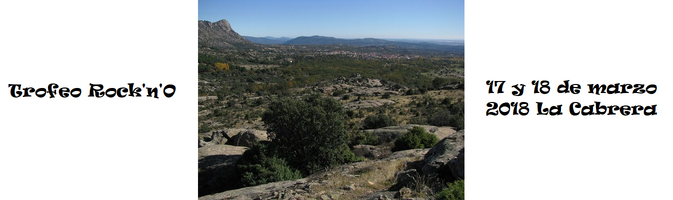
Terrain Images